
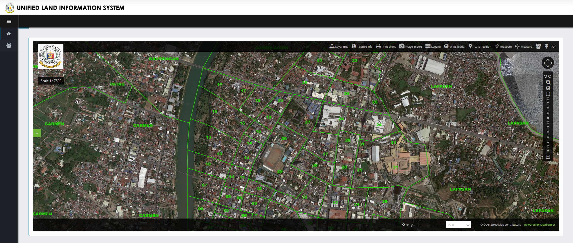
ULIS is a map of the city. But NOT just any map. It starts with a base map you can zoom in and out of. Then it shows exact barangay boundaries, lot parcels, tourism & other facilities, routes, hazard map and what’s more–any part of the map can be downloaded and printed!
More than a geographic information system for cadastral and land-use mapping, Cagayan de Oro’s ULIS gives investors or any user both technical and workaday knowledge on any information that can be mapped. It shows where the fire station and police outposts/precints, hospitals/clinics & health centers, malls, supermarkets, public & private schools are.
Of course there is the usual barangay name, type, area & perimeter. But did you know you can measure distances from point to point in the map, measure area in square meters of any space that you indicate with your mouse? Cool, huh? Not only that, you can pin any POI (point of interest) in the map and get information snippet that you can share to colleagues or contacts online so you know you are on the same page/POI.
You get the same functionality on your phone like what you see below, or on a laptop like the photo above.
Source: UNIFIED LAND INFORMATION SYSTEM (ULIS)
Happy map-hunting!


